TNTmips is MicroImages' flagship product for geospatial analysis. It offers a level of data and process
integration that is unmatched in any other professional system. TNTmips is the most technically advanced and
easy to use professional system.

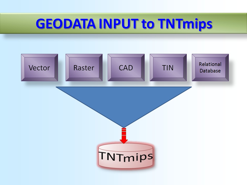
TNTmips
Use TNTmips for
SALIENT FEATURES
- Integration of GIS, Remote Sensing and Image Processing
- Radiometric Correction of satellite images
- Lens Correction for aerial camera images
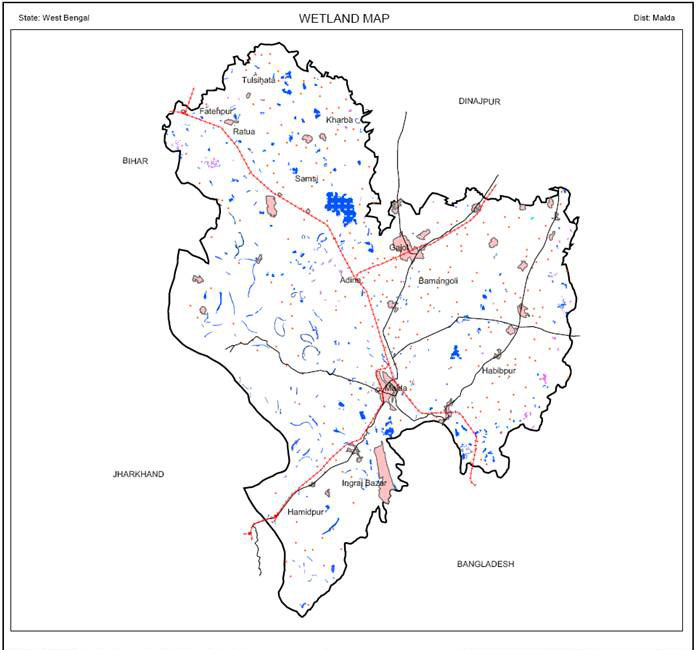
- Thematic Mapping
- Making Map Layout (Cartography)
- Managing Relational Database
- Vector Georeference
- Import GPS Data
- Convert Raster to Vector - autotrace
- Multi-resolution Fusion
- Principal Component Analysis
- Orthorectification using RPC
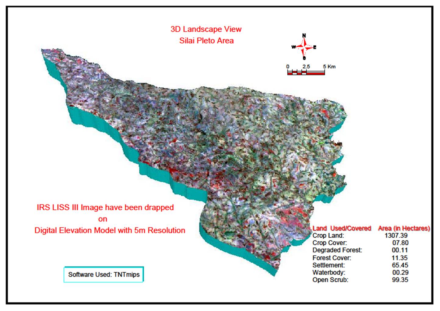
- Surface Modeling
- LIDAR Data Analysis
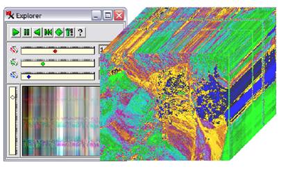
- Hyperspectral Image Analysis
- Spatial Analysis & Modeling
- Cut and Fill Analysis
- Watershed Analysis