PHOTOMOD
BASIC MODULES
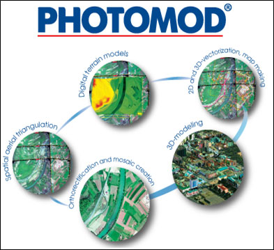
UAV ( or unmanned aircraft system – UAS):
Creation of UAS project, image block forming, interior orientation of block images,
automatic measurement of tie points coordinates on images, relative orientation of block images and also image block adjustment.
Import of triangulation points from PAT-B and X-POINTS; Import of ground control points from text files (*.txt, *.csv);
Import of interior and exterior orientation data from metadata; Import of external orientation data from PAT-B and CSV-files; GPS data;
Create Digital Terrain Model (DTM) – digital cartographic presentation of terrain surface both as regular grid of elevations (DEM) and as triangulated irregular network (TIN).
Create 3D vector objects; orthophoto production.
Stereo Processor:
Stereo Processor is an integrated software package specially intended for generation of the ground relief digital elevation models (DEM) via processing of the pairs of images acquired by spaceborne SAR's. Stereo processor provides for users an extraction of terrain height information from stereo pairs of SAR satellite imagery. It allows to generate an accurate digital elevation models (DEMs) of imaged ground surface.
Oil Spill Detection Processor :
Oil slicks detection processor is intended for oil slicks detection against a background of homogeneous sea surface.
Sea-Waves Analysis Module :
Sea waves analysis software tool is intend for automatic generation of estimates of spatial period, direction of propagation and height of large energy carrying waves over radar images of sea surface.
Ship Detection Module :
Ship detection processor is designated for processing of spaceborne radar images acquired over sea and ocean surface in part of ships finding and evaluation of their most valuable parameters, the like of speed of ships, their sizes, and cartographical coordinates
Interferometric Processor:
Stereo Processor is an integrated software package specially intended for generation of the ground relief digital elevation models (DEM) via processing of the pairs of images acquired by spaceborne SAR's. Stereo processor provides for users an extraction of terrain height information from stereo pairs of SAR satellite imagery. It allows to generate an accurate digital elevation models (DEMs) of imaged ground surface.
Polarimetric Processor :
Polarimetric processor realizes the technique of joint processing of images acquired with different signal polarization. In common case it allows classifying
the resolution cells on images upon their physical properties.
Input data for polarimetric processor are the radar images presented in complex format, path coordinate system, in slant range projection.
Processor can deal both with full polarimetric matrix (four combination of polarizations for transmited and received signals) on input
and with incomplete polarimetric matrix (two combination).